
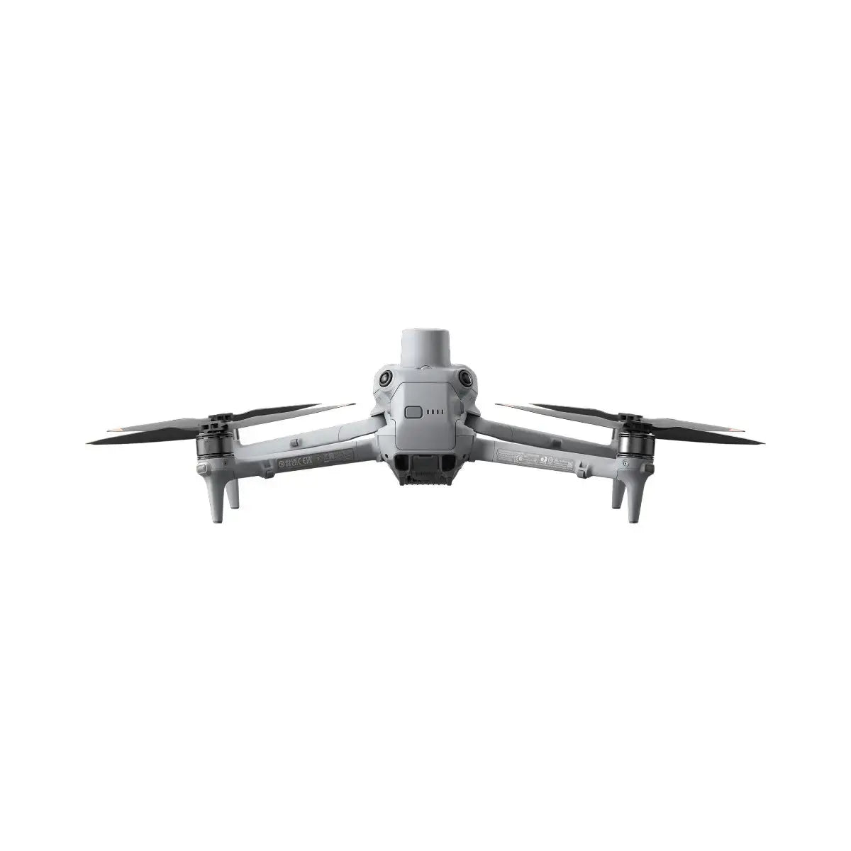
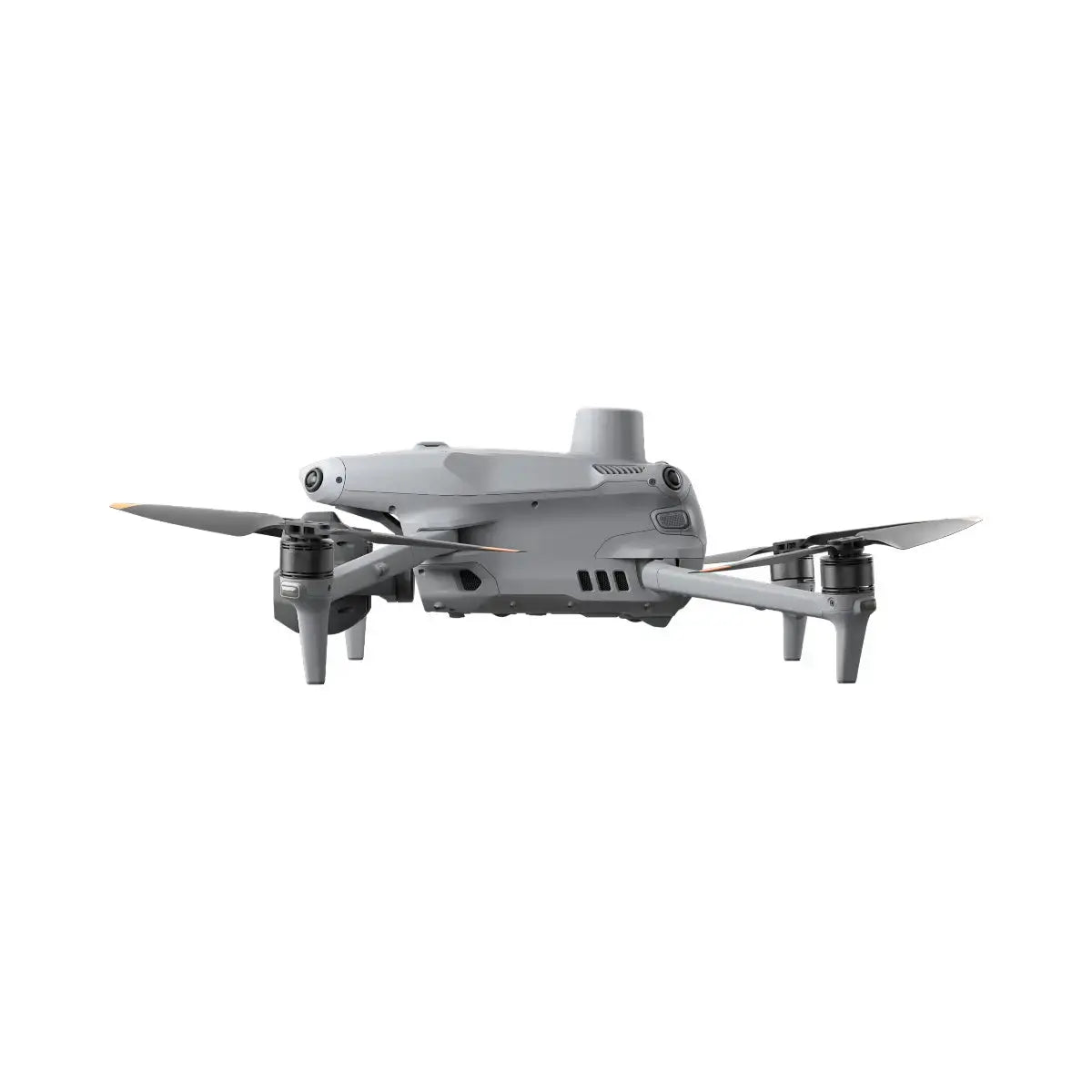
Overview
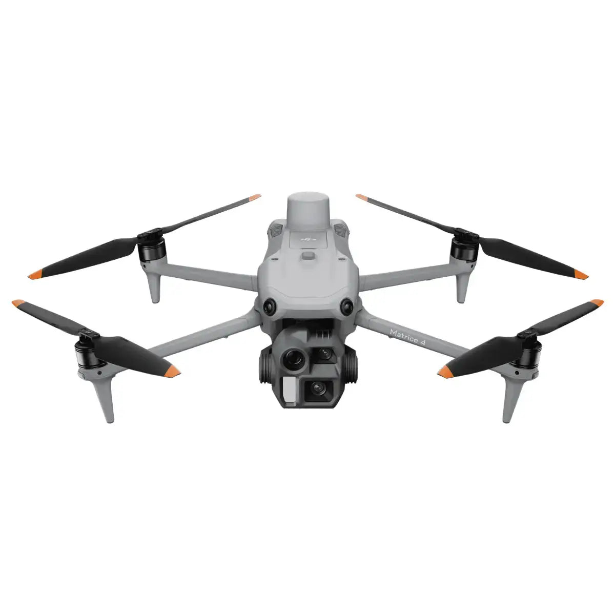
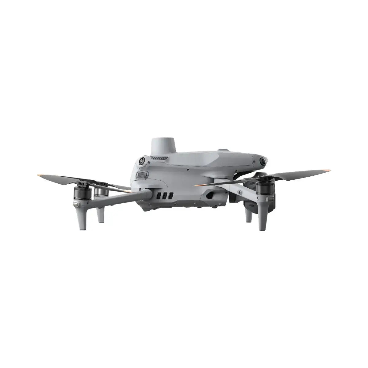
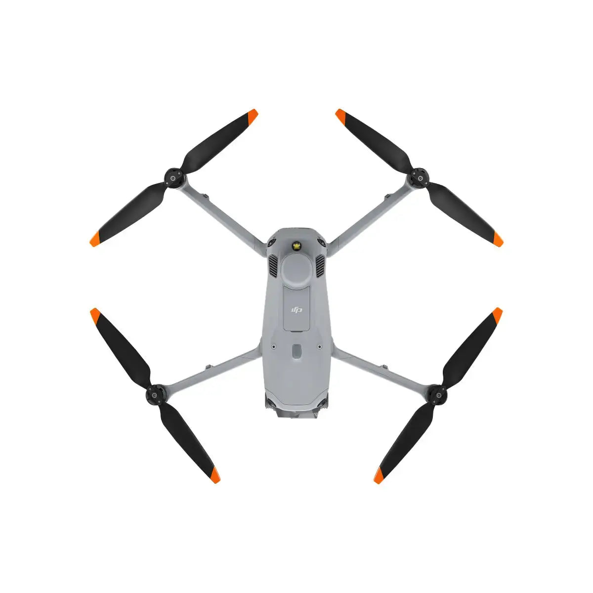
The DJI Matrice 4E is a next-generation surveying and mapping drone engineered for geospatial professionals who demand accuracy, efficiency, and reliability. As part of the Matrice 4 Series, it combines a high-performance 4/3" wide camera with multi-directional capture, Distortion Correction 2.0, and a remarkable 49-minute maximum flight time, making it an exceptional choice for large-scale surveys, digital twins, and complex 3D modeling.
With 5-directional oblique capture, fast 0.5-second shooting intervals, and factory-calibrated optics, the Matrice 4E streamlines end-to-end photogrammetry workflows—from flight planning to data capture to reconstruction in DJI Terra. Designed for demanding field environments, it pairs advanced obstacle sensing with a robust airframe and enterprise-grade transmission for confident operation in real-world conditions.
- Up to 49 minutes of flight time for extended missions and fewer battery swaps.
- 5-directional oblique capture improves mapping efficiency by up to 40%.
- 0.5-second capture interval for rapid, high-density data collection.
- Distortion Correction 2.0 keeps residual distortion under two pixels for survey-grade outputs.
- Factory-calibrated cameras for consistent, high-accuracy photogrammetry.
- Smart 3D Capture for streamlined 3D route planning directly from the RC Plus 2 controller.
- Enhanced obstacle sensing and enterprise-grade O4 video transmission for safe, reliable operations.
Key Features
Unparalleled Mapping Efficiency
-
Extended Endurance for Large Sites
Up to 49 minutes of flight time (no wind, standard propellers) allows the Matrice 4E to cover more area per sortie, reducing mission count and on-site time. -
5-Directional Oblique Capture
Capture nadir and oblique imagery in a single mission. The five-directional capture mode boosts mapping efficiency by up to 40%, ideal for dense urban environments, vertical structures, and complex terrain. -
High-Speed Data Collection
A 0.5-second minimum photo interval enables dense ground sampling at higher speeds, helping teams finish aerial surveys faster while maintaining data quality.
Precision Redefined
-
Distortion Correction 2.0
Advanced optical and algorithmic correction ensures residual distortion under two pixels, delivering highly accurate maps and models suitable for engineering, planning, and cadastral applications. -
Factory-Calibrated Camera System
Each wide camera is precision-calibrated at the factory to ensure consistent intrinsic parameters. When paired with DJI Terra, the Matrice 4E produces survey-grade reconstructions with minimal post-processing overhead.
Operational Simplicity & Safety
-
Smart 3D Capture
Plan and execute advanced 3D missions directly from the DJI RC Plus 2 Enterprise controller. Smart 3D Capture intelligently generates optimal flight paths for buildings, infrastructure, and complex sites—no additional laptop required in the field. -
Comprehensive Obstacle Sensing
An omnidirectional binocular vision system, supplemented by 3D infrared sensing on the underside, delivers robust obstacle detection forward, backward, laterally, upward, and downward—supporting safer operations in cluttered or dynamic environments. -
Enterprise-Grade O4 Transmission
The O4 Enterprise video transmission system provides up to 25 km FCC-rated range (environment dependent) with 1080p/30fps live view, multi-antenna redundancy, and low latency for precise control and situational awareness.
Professional Applications
Surveying & Mapping
-
Large-Scale Aerial Surveys
Ideal for national, municipal, and private-sector geospatial teams, the Matrice 4E combines long endurance, rapid capture intervals, and multi-directional imaging for high-productivity corridor and area mapping. -
Topographic & Photogrammetric Modeling
Achieve high-accuracy DSMs, DTMs, and orthomosaics with the calibrated camera system, Distortion Correction 2.0, and seamless integration with DJI Terra.
Construction, Infrastructure & Planning
-
Site Development & Progress Tracking
Generate detailed 3D models and progress reports for construction sites, industrial facilities, and infrastructure projects, supporting more accurate planning, billing, and stakeholder communication. -
Urban & Building Modeling
The 5-directional oblique imaging is ideal for digital twins, façade capture, urban planning, and heritage conservation, delivering rich detail on vertical surfaces and complex skylines.
Asset & Structural Inspections
-
Infrastructure & Structural Assessments
Use the wide and telephoto cameras to capture high-resolution imagery of bridges, towers, roofs, and industrial assets, enabling more informed maintenance decisions and documentation. -
High-Resolution Surface Analysis
Detailed imagery supports crack detection, material degradation assessment, and precise measurement workflows across critical infrastructure and large-scale assets.
Specifications
Aircraft
- Takeoff Weight (with propellers): 1219 g* (standard; includes battery, propellers, microSD card)
- Takeoff Weight (with low-noise propellers): 1229 g*
- Max Takeoff Weight: 1420 g (standard propellers), 1430 g (low-noise propellers)
- Dimensions: Folded: 260.6 × 113.7 × 138.4 mm (L × W × H); Unfolded: 307.0 × 387.5 × 149.5 mm (L × W × H), excluding propellers
- Max Payload: 200 g
- Propeller Size: 10.8 in; Propeller Model: 1157F (standard), 1154F (low-noise)
- Diagonal Wheelbase: 438.8 mm
- Max Ascent Speed: 10 m/s (6 m/s with certain accessories)
- Max Descent Speed: 8 m/s (6 m/s with accessories)
- Max Horizontal Speed (sea level, no wind): 21 m/s (forward), 18 m/s (backward), 19 m/s (sideways); limited to 19 m/s in Sport mode in EU regions
- Max Altitude: 6000 m; Max Operating Altitude with Payload: 4000 m
- Max Flight Time (no wind): Up to 49 min (standard propellers), 46 min (low-noise propellers)*
- Max Hover Time (no wind): Up to 42 min (standard propellers), 39 min (low-noise propellers)*
- Max Flight Distance (no wind): 35 km (standard), 32 km (low-noise)*
- Max Wind Speed Resistance: 12 m/s* (takeoff/landing)
- Max Pitch Angle: 35°
- Operating Temperature: -10°C to 40°C (14°F to 104°F)
- GNSS: GPS + Galileo + BeiDou + GLONASS* (GLONASS supported when RTK module enabled)
- Hovering Accuracy (no wind): ±0.1 m (Vision System), ±0.5 m (GNSS), ±0.1 m (RTK)
- RTK GNSS Accuracy: RTK Fix: 1 cm + 1 ppm (horizontal), 1.5 cm + 1 ppm (vertical)
- Internal Storage: N/A
- Ports: E-Port ×1 (official & third-party PSDK accessories), E-Port Lite ×1 (USB connection for tuning software / PSDK); install accessories before power-on
- Beacon: Integrated into aircraft
Camera System
-
Image Sensors (Matrice 4E):
Wide: 4/3" CMOS, Effective Pixels: 20 MP
Medium Tele: 1/1.3" CMOS, Effective Pixels: 48 MP
Telephoto: 1/1.5" CMOS, Effective Pixels: 48 MP -
Lens:
Wide (4E): FOV 84°, 24 mm equivalent, aperture f/2.8–f/11, focus 1 m to ∞
Medium Tele: FOV 35°, 70 mm equivalent, aperture f/2.8, focus 3 m to ∞
Telephoto: FOV 15°, 168 mm equivalent, aperture f/2.8, focus 3 m to ∞ -
ISO Range (4E):
Wide: ISO 100–204800
Medium Tele: ISO 100–409600
Telephoto: ISO 100–409600 -
Shutter Speed (4E):
Wide: Electronic 2–1/8000 s; Mechanical 2–1/2000 s
Medium Tele: 2–1/8000 s
Telephoto: 2–1/8000 s -
Max Photo Size (4E):
Wide: 5280 × 3956
Medium Tele: 8064 × 6048
Telephoto: 8192 × 6144 - Minimum Photo Interval: 0.5 s (Matrice 4E)
-
Still Photo Modes (4E):
Single: 20 MP (wide), 12/48 MP (medium tele & telephoto)
Interval: Configurable JPEG/JPEG+RAW intervals (0.5–60 s) depending on lens and mode
Panorama: 20 MP raw images, up to 100 MP stitched output (wide) - Video Codec & Resolution: H.264/H.265, CBR/VBR; 4K 3840 × 2160@30fps, FHD 1920 × 1080@30fps
- Max Video Bitrate: H.264: 60 Mbps; H.265: 40 Mbps
- File System: exFAT
- Photo Format: Wide: JPEG/DNG (RAW); Medium Tele & Telephoto: JPEG
- Video Format: MP4 (MPEG-4 AVC/H.264)
- Digital Zoom: Telephoto: up to 16× (112× hybrid zoom)
Gimbal
- Stabilization: 3-axis (tilt, roll, pan)
-
Mechanical Range (4E):
Tilt: -140° to 50°; Roll: -52° to 52°; Pan: -65° to 65°
Soft Limits: Tilt: -90° to 35°; Roll: -47° to 47°; Pan: -60° to 60° - Controllable Rotation Range (4E): Tilt: -90° to 35°; Pan: not controllable (MSDK interface can control)
- Max Control Speed (tilt): 100°/s
- Angular Vibration Range: ±0.007°
- Ingress Protection: No standard protection level (gimbal assembly)
- Operating Temperature: -10°C to 40°C (14°F to 104°F)
Sensing & Obstacle Avoidance
- Sensing Type: Omnidirectional binocular vision system + 3D infrared sensor on underside
- Forward: Measurement range 0.4–22.5 m (binocular), up to 200 m (detection), obstacle avoidance speed ≤21 m/s, FOV 90° (H), 135° (V)
- Backward: 0.4–22.5 m (measurement), up to 200 m (detection), obstacle avoidance speed ≤21 m/s, FOV 90° (H), 135° (V)
- Lateral: 0.5–32 m (measurement), up to 200 m (detection), obstacle avoidance speed ≤21 m/s, FOV 90° (H), 90° (V)
- Downward: 0.3–18.8 m (measurement), obstacle avoidance speed ≤10 m/s; FOV 160° front/rear and 160° left/right
- Operating Environment: Surfaces with clear patterns and adequate lighting; downward sensing requires textured surfaces with >20% reflectivity and illumination no lower than a nighttime city scene.
Video Transmission
- System: O4 Enterprise
- Live View Quality: 1080p/30fps (remote controller)
- Operating Frequencies: 2.400–2.4835 GHz; 5.725–5.850 GHz; 5.150–5.250 GHz (region dependent)
-
Transmitter Power (EIRP):
2.4 GHz: ≤33 dBm (FCC), ≤20 dBm (CE/SRRC/MIC)
5.8 GHz: <33 dBm (FCC), <30 dBm (SRRC), <14 dBm (CE)
5.15–5.25 GHz: <23 dBm (FCC/CE) - Max Transmission Distance (ideal conditions): 25 km (FCC), 12 km (CE/SRRC/MIC)*
- Max Transmission Distance (with interference): Approx. 1.5–25 km depending on interference level and environment*
- Max Download Speed: Up to 20 MB/s (near, interference-free)
- Typical Latency: ~130 ms under near-field, low-interference conditions
- Antenna: 8 antennas, 2T4R
- Other: Dedicated cellular dongle compartment
Memory & Storage
- Supported microSD Cards: U3 / Class 10 / V30 or higher
- Recommended microSD Cards: Lexar 1066x (64/128/256/512 GB U3 A2 V30), Kingston Canvas GO! Plus (64/128/256/512 GB U3 A2 V30)
Intelligent Flight Battery
- Capacity: 6741 mAh
- Standard Voltage: 14.76 V
- Max Charging Voltage: 17.0 V
- Cell Type: Li-ion 4S
- Energy: 99.5 Wh
- Weight: 401 g
- Recharging Temperature: 5°C to 40°C (41°F to 104°F)
- Discharge Rate: 4C
- Max Charging Power: 1.8C
- Low-Temperature Charging: Not supported
- Cycle Count (reference): Approx. 200 cycles
Power Adapter (100 W)
- Input: 100–240 V AC, 50–60 Hz, 2.5 A
- Output: Max 100 W total; when both ports are used, max 82 W on a single port with dynamic power allocation
- Rated Power: 100 W
Charging Hub
- Input: USB-C: 5–20 V, up to 5 A
- Output: Battery interface 11.2–17 V
- Rated Power: 100 W
- Charging Mode: Sequential charging of up to 4 batteries; supports Standard Mode (100% SOC) and Standby Mode (90% SOC)
- Compatible Battery: DJI Matrice 4E/T Series Intelligent Flight Battery
- Charging Temperature: 5°C to 40°C (41°F to 104°F)
DJI RC Plus 2 Enterprise
- Transmission System: O4 Enterprise
- Max Transmission Distance: Up to 25 km (FCC), 12 km (CE/SRRC/MIC)*
- Image Transmission Bands: 2.4000–2.4835 GHz, 5.725–5.850 GHz, 5.1 GHz (receive only)
- Antenna: 2T4R built-in multi-beam high-gain antenna
-
Video Transmission Power (EIRP):
2.4 GHz: <33 dBm (FCC), <20 dBm (CE/SRRC/MIC)
5.1 GHz: <23 dBm (CE)
5.8 GHz: <33 dBm (FCC), <14 dBm (CE), <30 dBm (SRRC) - 4G Transmission: Supports DJI Cellular Dongle 2
- Wi-Fi: Wi-Fi Direct, Wireless Display, IEEE 802.11a/b/g/n/ac/ax, 2×2 MIMO, dual band simultaneous (DBS), up to 1774.5 Mbps (2×2 + 2×2 11ax DBS)
- Wi-Fi Bands: 2.4000–2.4835 GHz, 5.150–5.250 GHz (regional restrictions apply)
- Wi-Fi Power (EIRP): 2.4 GHz: <26 dBm (FCC), <20 dBm (CE/SRRC/MIC); 5.1 GHz: <23 dBm (FCC); 5.8 GHz: <23 dBm (FCC/SRRC), <14 dBm (CE)
- Bluetooth: Bluetooth 5.2, 2.400–2.4835 GHz, <10 dBm EIRP
- Screen: 7.02" LCD touchscreen, 1920 × 1200, 60 fps, 1400 nits brightness
- Touch: 10-point multi-touch
- Built-in Battery: 2S2P high energy density 18650 Li-ion, 6500 mAh @ 7.2 V (46.8 Wh); approx. 3.8 hours runtime
- External Battery: Optional WB37, 4920 mAh @ 7.6 V (37 Wh); approx. 3.2 hours additional runtime
- Charging: Supports PD fast charging up to 20 V / 3.25 A via USB-C; approx. 2 hours with standard DJI charger (internal or internal + external)
- Storage: 128 GB internal ROM + microSD expansion
- Output Port: HDMI 1.4
- Indicators: Status, power, permission lights; brightness auto-adjustable
- Audio & MIC: Integrated speaker (buzzer support) and array microphone
- Operating Temperature: -20°C to 50°C (-4°F to 122°F)
-
Storage Temperature:
Within 1 month: -30°C to 45°C (-22°F to 113°F)
1–3 months: -30°C to 35°C (-22°F to 95°F)
3–12 months: -30°C to 30°C (-22°F to 86°F) - Recharging Temperature: 5°C to 40°C (41°F to 104°F)
- Supported Aircraft: DJI Matrice 4T / 4E
AL1 Spotlight (Optional)
- Weight: 99 g (with bracket); approx. 91 g (without bracket)
- Dimensions: 95 × 164 × 30 mm (with bracket); 79 × 164 × 28 mm (without bracket)
- Max Power: 32 W
- Illuminance: 4.3±0.2 lux @ 100 m; 17±0.2 lux @ 50 m (lab conditions, 25°C)
- Effective Illumination Angle: 23° (10% relative illumination)
- Effective Illumination Area: ~1300 m² @ 100 m (Normal Mode), ~2200 m² @ 100 m (Wide FOV Mode)
- Operating Modes: Always-on and strobe
- Gimbal Range: Tilt -140° to 50°; controllable tilt -90° to 35°; max tilt speed 120°/s
- Alignment Accuracy: ±0.1°
- Operating Temperature: -20°C to 50°C (-4°F to 122°F)
- Mounting: Quick-release, hand-tightened screws
AS1 Speaker (Optional)
- Weight: 92.5 g (with bracket); approx. 90 g (without bracket)
- Dimensions: 73 × 70 × 52 mm (with bracket); 73 × 70 × 47 mm (without bracket)
- Max Power: 15 W
- Max Volume: Up to 114 dB @ 1 m (lab conditions, 25°C)
- Effective Broadcast Distance: ~300 m (environment dependent)
- Broadcast Modes: Real-time broadcasting (with echo suppression), recorded playback, media import (simultaneous transmission and playback), and text-to-speech (currently supports Chinese and English with latest firmware)
- Operating Temperature: -20°C to 50°C (-4°F to 122°F)
- Mounting: Quick-release, hand-tightened screws
Notes
* All flight times, distances, and transmission ranges are based on ideal test conditions and are provided for reference only. Actual performance will vary depending on payload, environment, and operational parameters.
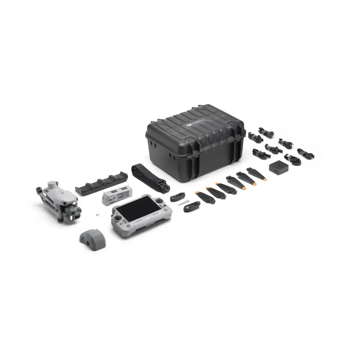
In The Box
- 1 × DJI Matrice 4E Aircraft
- 1 × DJI Matrice 4 Series Intelligent Flight Battery
- 1 × DJI RC Plus 2 Enterprise Remote Controller
- 1 × DJI 100W USB-C Power Adapter
- 1 × DJI Matrice 4 Series Charging Hub
- 1 × microSD Card
- 1 × DJI Matrice 4E Gimbal Protector
- 1 × DJI Cellular Dongle 2 Pry Bar
- 3 × DJI Matrice 4 Series Propellers
- 1 × 100 W Power Adapter AC Cable
- 1 × USB-C to USB-C Data Cable
- 1 × USB-A to USB-C Data Cable
- 1 × DJI Matrice 4 Series Storage Case
- 1 × DJI Matrice 4 Series Storage Case Shoulder Strap