
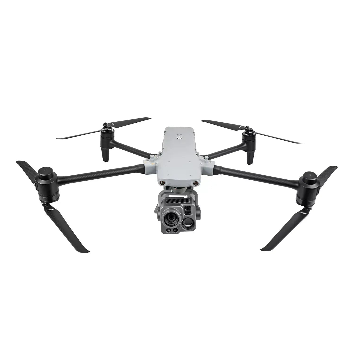
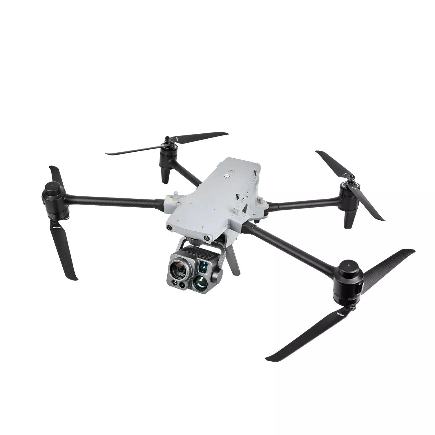
Meet the Autel Alpha DG-L35T – an intelligent, multi-purpose enterprise drone platform built for public safety, utilities, critical infrastructure, and complex industrial inspections. With a rugged IP55 weather rating, foldable design, dual hot-swappable batteries, and precise RTK positioning, the Alpha is engineered to deliver reliable performance in demanding real-world conditions.
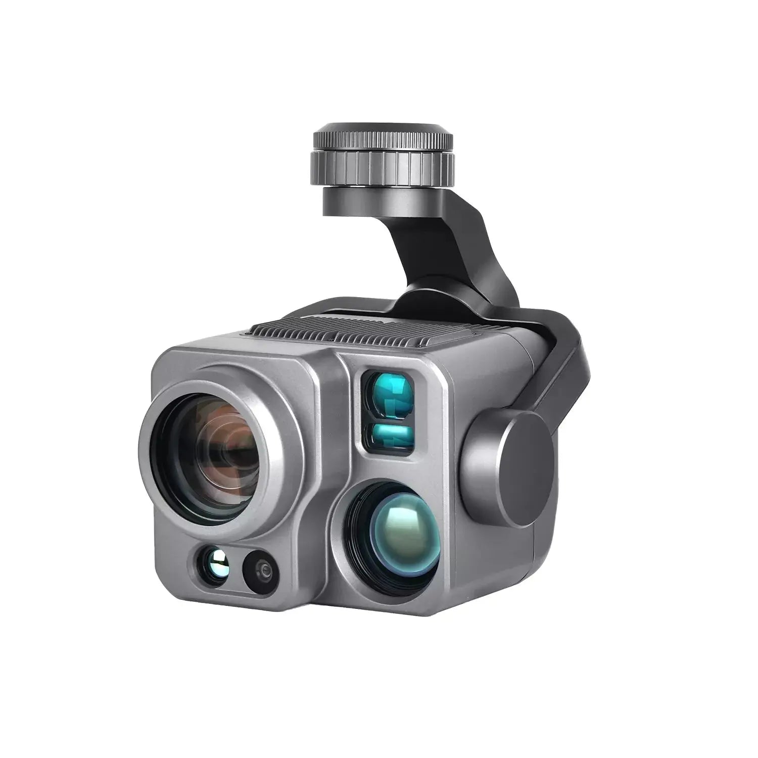
At the heart of the system is the DG-L35T multi-sensor gimbal, combining a 560× super hybrid zoom camera, dual thermal channels, a 48 MP wide camera, ultra-sensitive starlight night-vision, and an integrated laser rangefinder. Paired with A-Mesh networking, 720° omnidirectional obstacle avoidance, and SkyLink 3.0 long-range transmission, the Autel Alpha is a serious tool for teams that need dependable, actionable aerial data.
- Rugged IP55-rated industrial UAS for multi-mission enterprise use.
- DG-L35T gimbal with 4K zoom, dual thermal, starlight night vision, and laser ranging.
- RTK dual-antenna positioning for centimeter-level accuracy.
- SkyLink 3.0 transmission with up to 12.4-mile (20 km) image link and 1080p/30fps live view.
- Hot-swappable dual batteries with up to 40 minutes of flight time (ideal conditions).
- Designed for public safety, energy, infrastructure, and emergency response workflows.
Imaging & Payload
DG-L35T Multi-Sensor Gimbal
The Autel DG-L35T gimbal integrates multiple high-performance sensors into a single, field-ready payload, delivering exceptional detail and flexibility for day, night, and thermal operations.
- Multi-Sensor Design: Wide camera, long-range zoom camera, dual thermal cameras (wide + tele), and integrated laser rangefinder.
- Mission-Ready Imaging: Designed for inspection, search and rescue, overwatch, and technical scene documentation.
Wide Camera
- Sensor: 1/2" CMOS, effective pixels: 48 MP
- Lens: 84° DFOV, 24 mm equivalent focal length, f/2.8, focus 1 m to ∞
-
ISO Range:
Photo: ISO 100–6400
Video: ISO 100–64000 (Night scene mode up to ISO 256000)
Zoom Camera
- Sensor: 1/1.8" CMOS
-
Lens:
FOV: 66.7°–34.6°
Focal Length: 34.7–838 mm
Aperture: f/1.61–f/5.19 -
Zoom Range:
Optical zoom: 1×–35×
Digital zoom: up to 560× hybrid -
ISO Range:
Photo: ISO 100–6400
Video: ISO 100–64000 (Night scene mode up to ISO 320000) -
Photo: 8-bit JPG / 12-bit DNG, 3840 × 2160
Video: MP4 / MOV, up to 3840 × 2160 @ 30 fps
Dual Thermal Cameras – Wide & Tele
- Sensor (both): Uncooled VOx microbolometer
Wide Thermal
- FOV: 42°
- Focal length: 13 mm, f/1.2
- Resolution: 640 × 512 @ 25 fps
- Temperature measurement: –20°C to +150°C, 0°C to +550°C
- Accuracy: ±3°C or ±3% of reading (whichever is greater), at –20°C to +60°C (–4°F to 140°F)
Tele Thermal
- FOV: 12.3°
- Focal length: 45 mm, f/1.2
- Resolution: 640 × 512 @ 25 fps
- Wide digital zoom: 1×–3.5×; tele digital zoom: 3.5×–56×
- Temperature ranges and accuracy as above (–20°C to +150°C, 0°C to +550°C, ±3°C or ±3%).
Super Zoom & Night Vision
- 4K / 35× continuous optical zoom and up to 560× hybrid zoom for ultra-long-range observation.
- Identify key details at long distances, including license plates under suitable conditions.
- Ultra-sensitive starlight imaging with extremely high ISO support for low-light missions.
Laser Rangefinder
- Measuring range: 10–2000 m
-
Measurement accuracy: ± (1 m + D × 0.15%)
*D is the distance to a vertical surface - Tap a target in the live view or map to retrieve latitude, longitude, and altitude rapidly.
Platform, Autonomy & Safety
Rugged Flight Platform
- Weather Rating: IP55, built for all-weather field deployment.
- Wind Resistance: Up to 15 m/s (~27 mph).
- Service Ceiling: Up to 23,000 ft (ideal conditions).
- Operating Temperature: –20°C to +50°C (–4°F to 122°F).
- Max Flight Time (no wind): Up to 40 minutes; max hover ~38 minutes (no wind, standard conditions).
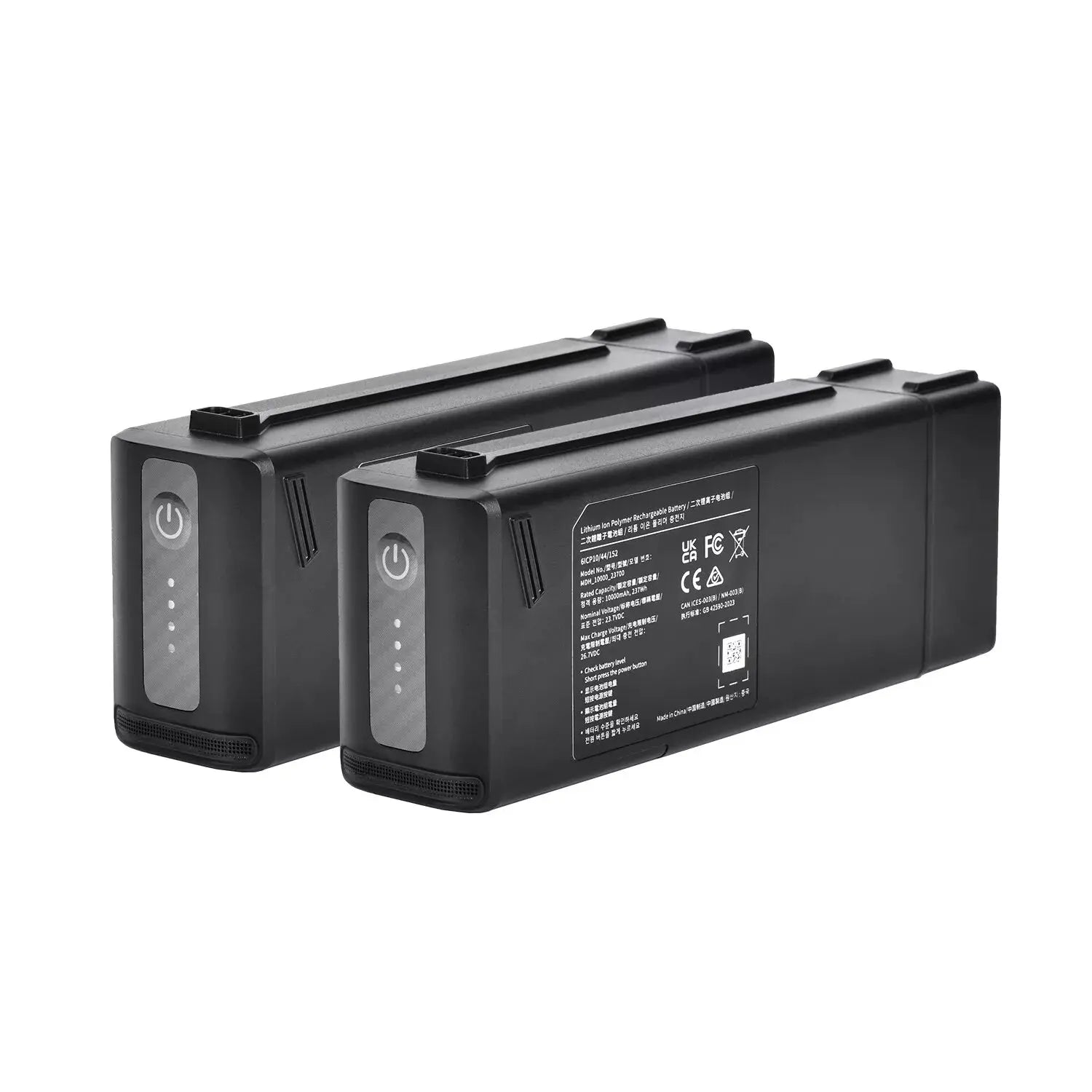
- Hot-Swappable Dual Batteries: Seamless battery changes for continuous operations.
Aircraft Performance
- Weight (with battery & gimbal): 6100 g
- Max payload: 3000 g
-
Dimensions:
Unfolded (incl. propellers): 1185 × 942 × 262 mm
Unfolded (excl. propellers): 788 × 551 × 255 mm
Folded (excl. propellers): 453 × 262 × 245 mm - Diagonal wheelbase: 810 mm
- Max horizontal speed: 24 m/s (windless, near sea level)
-
Hovering accuracy:
Vertical: ±0.1 m (vision), ±0.3 m (GNSS)
Horizontal: ±0.15 m (vision), ±0.3 m (GNSS) - GNSS: GPS + GLONASS + BeiDou + Galileo
Autonomy & Obstacle Avoidance
-
720° omnidirectional obstacle avoidance via multi-sensor fusion:
5-direction dual fisheye vision + 6-direction millimeter-wave radar. - Supports obstacle detection and avoidance, including at night, for safer low-altitude and complex-terrain flight.
- Auto Path Finding: Autel’s Autonomy Engine collects environmental data and plans intelligent 3D flight paths through mountains, forests, buildings, and other complex environments.
A-Mesh Networking & SkyLink 3.0
- A-Mesh Network: Drone-to-drone and drone-to-controller networking supports single-controller multiple drones and master-slave dual-control modes.
- Ideal for long-distance, obstructed, or off-grid environments where public networks are unavailable.
-
SkyLink 3.0 Transmission:
– Up to 12.4 miles (20 km) image transmission distance (ideal conditions)
– 1080p/30fps real-time image quality
– Up to 64 Mbps data rate -
Frequency bands (region-dependent): 900 MHz / 2.4 GHz / 5.2 GHz / 5.8 GHz
*900 MHz for FCC regions; 5.2 GHz in FCC/CE/UKCA regions only. - Automatic frequency hopping selects the best channel to resist interference around powerlines, structures, and urban RF noise.
Enterprise App, Missions & AI
- Autel Enterprise App: Built specifically for industrial workflows, with a clean interface and semi-autonomous modes to streamline complex missions.
- Polygon Mission: One-click automatic generation of polygon-based flight areas for efficient coverage.
- Waypoint Mission: Flexible, non-structured waypoint paths for repeatable inspections and surveys.
- Quick Mission: Create temporary sub-missions on the fly while executing existing flights for maximum in-field flexibility.
- AI Target Recognition: Automatically detect and lock onto humans, vehicles, and boats using zoom, wide, or infrared cameras, projecting targets on the map for better coordination.
- Tripod Mode: Locks the gimbal on a target and keeps it centered while the aircraft hovers – ideal for overwatch and observation.
Data Security
- Local-only access to sensitive flight data, including logs and location information.
- AES-256 encrypted storage for photos, videos, and logs with password protection.
- Designed to support strict enterprise and government data security requirements.
*All performance metrics (flight time, range, ceiling, etc.) are based on ideal test conditions and are for reference only. Actual results will vary with payload, environment, and operating style.
Specifications
- Aircraft Weight (with battery & gimbal): 6100 g
- Max Payload: 3000 g
- Dimensions (unfolded, incl. propellers): 1185 × 942 × 262 mm
- Dimensions (unfolded, excl. propellers): 788 × 551 × 255 mm
- Dimensions (folded, excl. propellers): 453 × 262 × 245 mm
- Diagonal Wheelbase: 810 mm
- Max Flight Time (windless): 40 minutes
- Max Hovering Time (windless): 38 minutes
- Max Horizontal Speed: 24 m/s (windless, near sea level)
- Max Wind Resistance: 15 m/s
- Ingress Protection Rating: IP55
- Operating Temperature: –20°C to +50°C (–4°F to 122°F)
- GNSS: GPS + GLONASS + BeiDou + Galileo
DG-L35T Gimbal – Highlights
- Wide Camera: 1/2" CMOS, 48 MP, 84° DFOV, 24 mm eq., f/2.8, ISO up to 64000 (video night mode).
- Zoom Camera: 1/1.8" CMOS, 4K, 1×–35× optical, up to 560× hybrid, ISO up to 320000 (night mode).
- Thermal Cameras: Dual 640 × 512 (wide + tele), –20°C to +150°C / 0°C to +550°C ranges, ±3°C or ±3% accuracy.
- Laser Rangefinder: 10–2000 m measuring range, ± (1 m + D × 0.15%) accuracy.
Transmission & Networking
- Transmission System: SkyLink 3.0
- Max Image Transmission Distance: Up to 12.4 miles (20 km) in ideal conditions
- Live View: 1080p @ 30 fps, up to 64 Mbps
-
Frequency Bands (region-dependent):
900 MHz / 2.4 GHz / 5.2 GHz / 5.8 GHz - Networking: A-Mesh multi-drone and multi-controller support
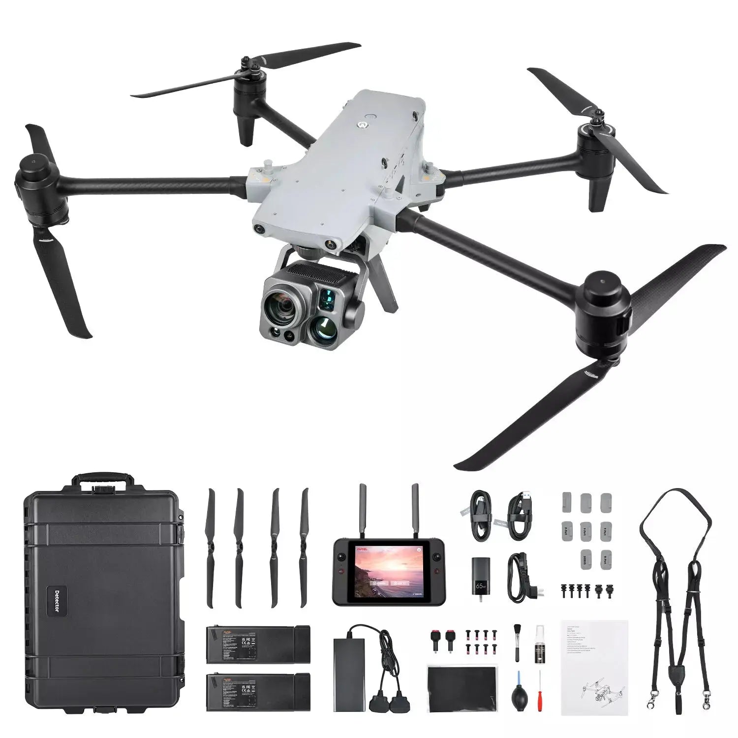
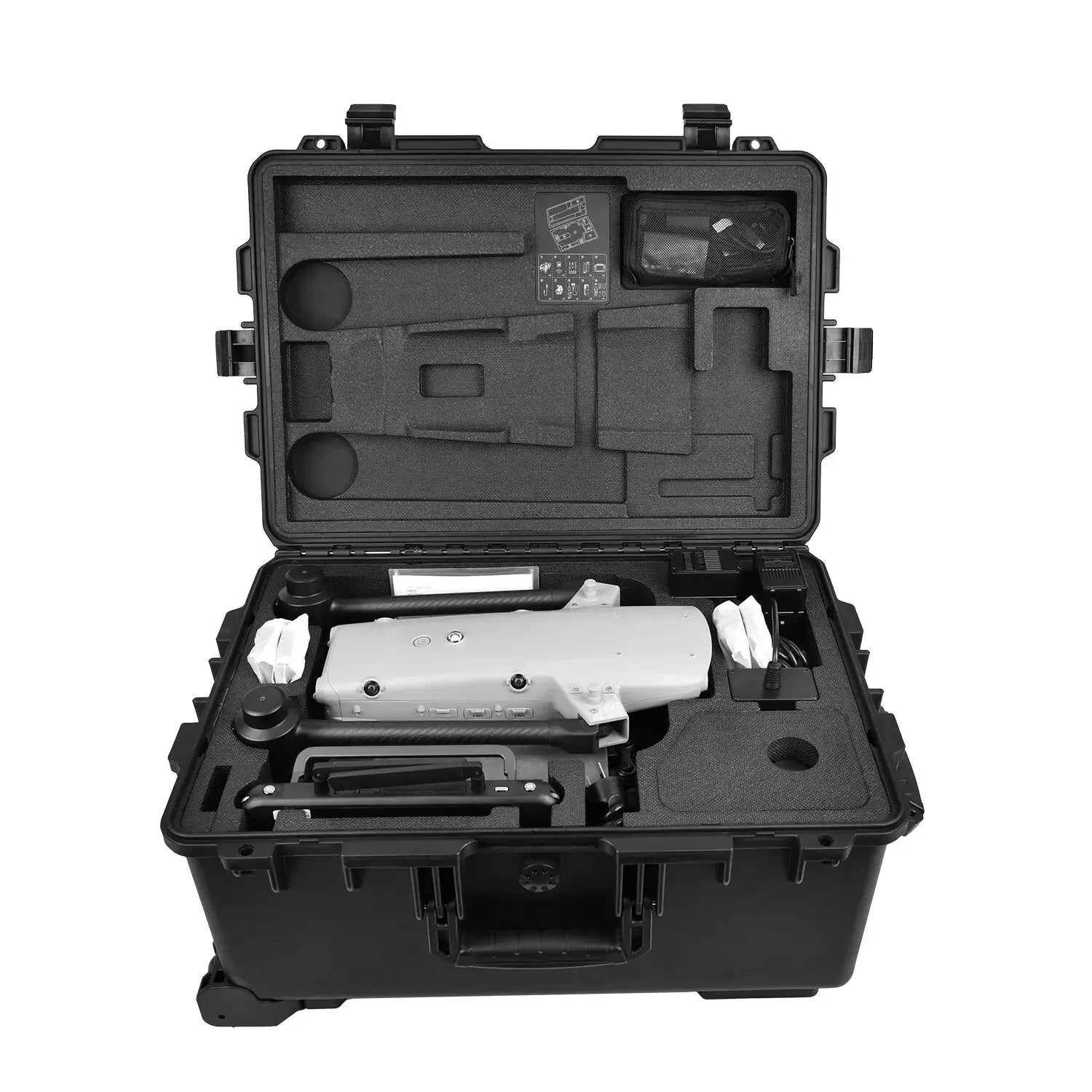
In The Box
- Autel Alpha Drone
- DG-L35T Camera Payload
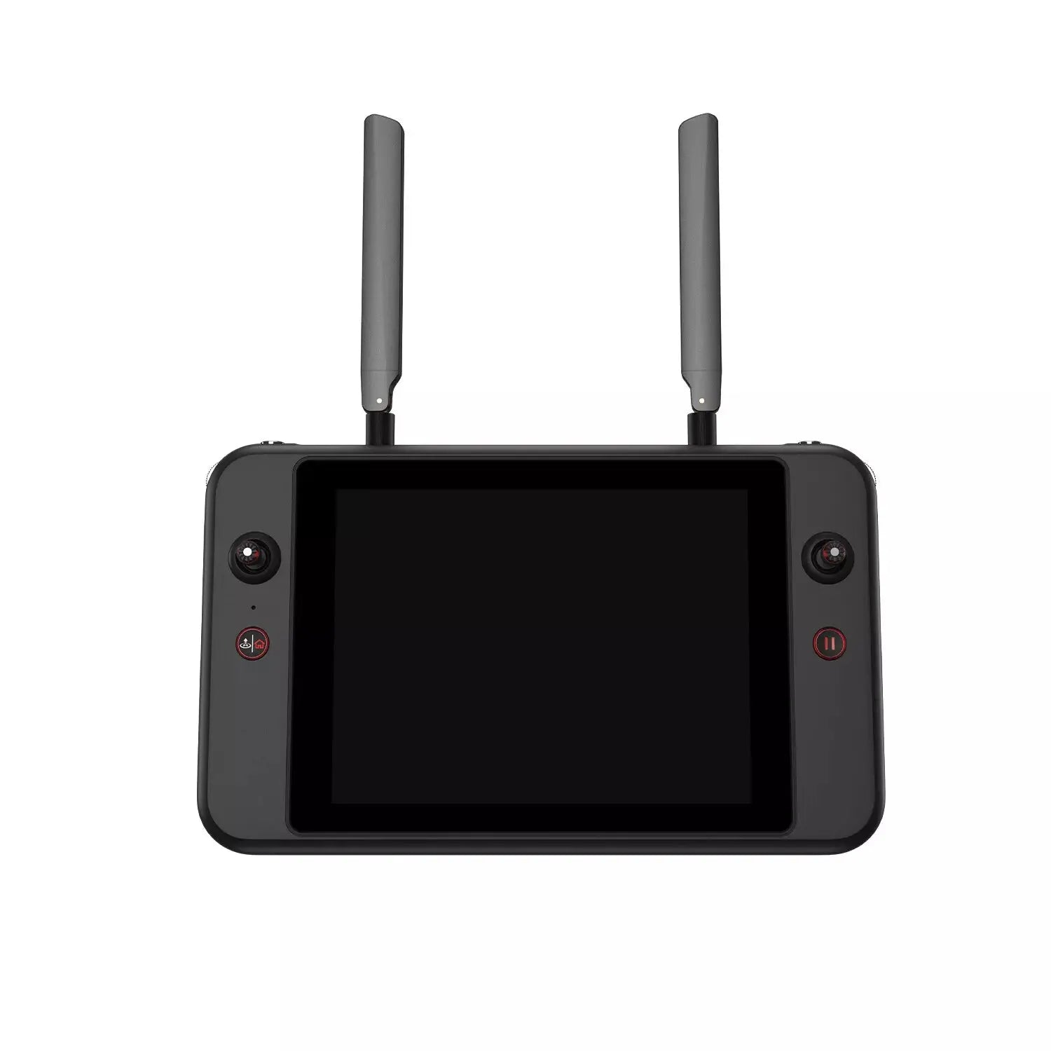
- V3 Smart Controller
- 2 × Flight Batteries
- Battery Charger
- Spare Propellers
- Cables & Adapters
- Lanyard & Screwdriver
- Cleaning Kit
- User Manuals & Documentation